Friday, February 5, 2016

Maryland Road Trip January 2016

Maryland Road Trip January 2016


We were enjoying a mild winter, prior to the arrival of the Blizzard of 2016. One of the great things about living in the West Virginia Eastern Panhandle is that you are in close proximity to scenic areas of West Virginia, Maryland, Virginia, and Pennsylvania. We hit the road one weekend to explore Maryland to our north and east.  Feel free to check out the links to learn more about the places we visited.


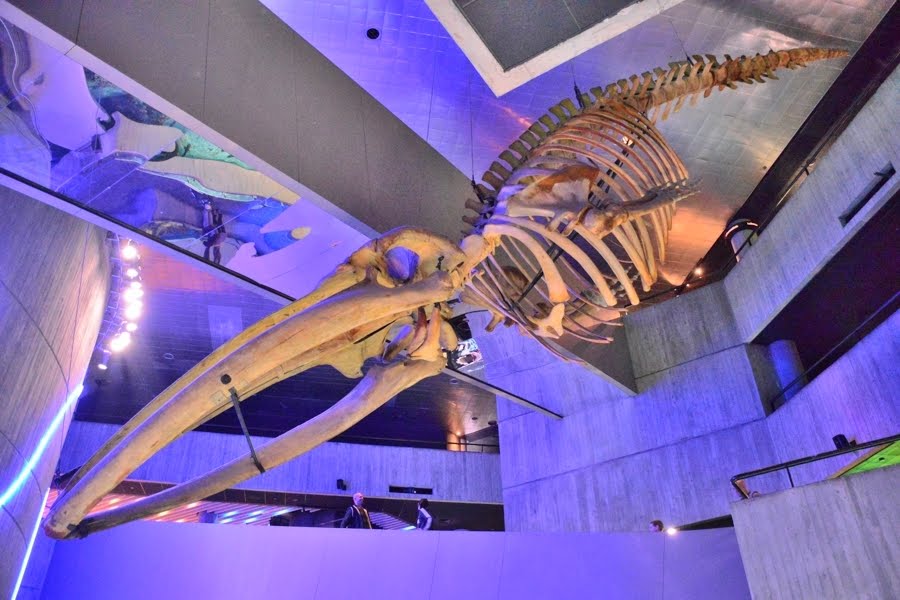
National Aquarium


“Today, the National Aquarium, Baltimore, features a living collection of more than 20,000 fish, birds, amphibians, reptiles and marine mammals living in award-winning habitats. In summer 2013, the Aquarium opened Black tip Reef, a breathtaking exhibit replicating an Indo-Pacific reef and featuring more than 700 animals, including a school of black tip reef sharks.”


We really enjoyed our visit here!  There was plenty to see and do as we explored the multiple levels.  All of the staff were very knowledgeable and were great to talk to.  We spent several hours on this portion of our weekend adventure.  There are plenty of places to eat along the Inner Harbor of Baltimore.


“One of Inner Harbor’s most popular attractions, the National Aquarium features an incredible 20,000 animals in award-winning habitats. Explore a tropical rainforest, the animals of the Australian Outback, an Atlantic coral reef, hundreds of jellyfish, 4D immersion films and their newest exhibit the "Living Seashore". Special add-on tours give you a behind-the-scenes look at life in the aquarium. Care to toe a catwalk, just inches from swimming sharks? Or perhaps you’re dreaming of a sleepover with dolphins. You’ll need several hours to peruse this Baltimore aquarium, and you'll love every minute of it.”


Frederick County Covered Bridges


“The Roddy Road, Loy's Station, and Utica Mills bridges are three of only eight remaining covered bridges in the state of Maryland. At least 52 such structures once graced the landscape of the state, but storms, fires, progress, and neglect have claimed almost all of them. The three bridges provide a good comparative study of wood bridge truss techniques, as each displays a different truss design. Weather permitting, be sure to bring a picnic as each of the three bridge sites features an adjacent recreation area.”


This area is very scenic and fairly easy to explore.  The three bridges are close to each other and not from from Frederick, MD.  We will be back at different times of the year to enjoy the different views each season has to offer.  I am guessing fall foliage will have an incredible affect on these covered bridges.


“Northern Frederick County is home to three historic covered bridges. All three bridges are listed on the National Park Service’s National Register of Historic Places. The Utica Mills, Loy’s Station, and Roddy Road covered bridges all cross streams in northern Frederick County, within twelve miles of one another. Besides their beauty, the bridges are also structurally interesting, as all three have different truss systems (which is what keeps a bridge standing).”


Catoctin Mountain Park


“Catoctin Mountain Park offers a variety of outdoor recreation experiences for visitors of all ages and abilities, and a place for rejuvenation. Here is some basic information to get you started with your planning.
The park is a short drive from major population centers. Check here for directions from Washington DC, Baltimore, Hagerstown and Gettysburg
Start your visit at the visitor center where you can pick up a map of the park and get recommendations for hikes or other things to do.
Lodging and Picnic areas are available within the park, but reservations are required for overnight stays.
Recreational opportunities are many, including: hiking, fishing, cross country skiing, camping, and much more.
Special events can be found on our calendar of events.
Good planning requires attention to safety concerns. Be sure to plan for the weather and be aware of plants, animals and hazardous conditions that may present a danger.
Many areas in the park are accessible by wheelchair, including: the Visitor Center, Spicebush Trail, Chestnut Picnic Area, the Sawmill exhibit, Camp Greentop and Camp Round Meadow.
Several other national parks and attractions are nearby.”


This area, operated by the National Park system, is in a very beautiful area.  Camp David, the Presidential Retreat, is also located here.  There are state parks nearby and a ton of hiking trails.  We started at the visitor center and then made our way to the Blue Blazes Trail.  It leads to a historic area where folks made moonshine whiskey years ago.  There are interpretive signs along the way to tell you about the area. This is another area we will return to in the future.


“Catoctin Mountain Park, located in north-central Maryland, is part of the forested Catoctin Mountain ridge that forms the eastern rampart of the Appalachian Mountains. Approximately 8 square miles (21 km2) in area, the park features sparkling streams and panoramic vistas of the Monocacy Valley.”


Cunningham Falls State Park


“Cunningham Falls State Park is located in the picturesque Catoctin Mountains. It is divided into two separate but unique areas. The William Houck Area located three miles west of Thurmont on Route 77 has the lake area, falls and camping area. The Manor Area off Route 15 three miles south of Thurmont has the Scales and Tales Aviary, camping and the historic Catoctin Iron Furnace.
Outdoor activity is everywhere at Cunningham Falls State Park. Leisure opportunities like swimming, hiking, fishing and canoeing are available. For those who wish to get away for either a night or longer there are campsites and camper cabins available for rental from April through October.”


We made the scenic hike to the falls as well as checked out the lake area.  Another visually pleasing area that I am betting sees lots of visitors during peak season. Looking forward to visiting again in the future.


Thanks for faithfully reading along to the end.  Hope you learned something new along the way and enjoyed the photos and our fun scenic adventure.  Please feel free to comment and share.


To see a list of all my blog entries, please go to this link:

Monday, February 1, 2016

Fog Blog

My Fog Blog


One of the first things we noticed about living in the West Virginia Eastern Panhandle was that it sure seemed too be foggy a lot.  I tried to capture the mood and feel of the fog.  I looked out on the Internet to see why it formed.  Of course I had to write this blog to share it with you all.


Don’t get me wrong.  I have lived a lot of places where fog formed.  Arizona, California, Florida, Okinawa, Utah, and beyond, all get fog.  It seemed like the conditions in West Virginia led to more fog than was usual to my experience in the first few months of living here.


Fog

“Fog is a cloud that touches the ground. Fog can be thin or thick, meaning people have difficulty seeing through it. In some conditions, fog can be so thick that it makes passing cars. Even monuments like London Bridge, in London, England, or the Golden Gate Bridge, in San Francisco, California, are almost impossible to see in thick fog.


Fog shows up when water vapor, or water in its gaseous form, condenses. During condensation, molecules of water vapor combine to make tiny liquid water droplets that hang in the air. You can see fog because of these tiny water droplets. Water vapor, a gas, is invisible.

Fog happens when it’s very, very humid. There has to be a lot of water vapor in the air for fog to form.


In order for fog to form, dust or some kind of air pollution needs to be in the air. Water vapor condenses around these microscopic solid particles. Sea fog, which shows up near bodies of salty water, is formed as water vapor condenses around bits of salt.

Depending on the humidity and temperature, fog can form very suddenly and then disappear just as quickly. This is called flash fog.


Fog is not the same thing as mist. Fog is denser than mist. This means fog is more massive and thicker than mist. There are more water molecules in the same amount of space in a fog. Fog cuts visibility down to one kilometer, meaning it will prevent you from seeing further away than one kilometer from where you’re standing. Mist can reduce visibility to between one and two kilometers.


Types of Fog

There are several different types of fog, including radiation fog, advection fog, valley fog, and freezing fog.

Radiation fog forms in the evening when heat absorbed by the Earth’s surface during the day is radiated into the air. As heat is transferred from the ground to the air, water droplets form. Sometimes people use the term “ground fog” to refer to radiation fog. Ground fog does not reach as high as any of the clouds overhead. It usually forms at night. Fog that is said to “burn off” in the morning sun is radiation fog.


Advection fog forms when warm, moist air passes over a cool surface. This process is called advection, a scientific name describing the movement of fluid. In the atmosphere, the fluid is wind. When the moist, warm air makes contact with the cooler surface air, water vapor condenses to create fog. Advection fog shows up mostly in places where warm, tropical air meets cooler ocean water. The Pacific coast of the United States, from Washington to California, is often covered in advection fog. The cold California Current, which runs along the western coast of North America, is much cooler than the warm air along the coast.


Valley fog forms in mountain valleys, usually during winter. Valley fog develops when mountains prevent the dense air from escaping. The fog is trapped in the bowl of the valley. In 1930, vapor condensed around particles of air pollution in the Meuse Valley, Belgium. More than 60 people died as a result of this deadly valley fog.


Freezing fog happens when the liquid fog droplets freeze to solid surfaces. Mountaintops that are covered by clouds are often covered in freezing fog. As the freezing fog lifts, the ground, the trees, and even objects like spider webs, are blanketed by a layer of frost. The white landscapes of freezing fog are common in places with cold, moist climates, such as Scandinavia or Antarctica.”


How Does Fog Form?

“The scene can be as spectacular as a view from above showing only the tops of city skyscrapers poking through or as disorienting as a sheet of gray directly in front of you.

While common in some locations, fog can simply amaze us.


According to the Glossary of Meteorology from the American Meteorological Society, fog is a collection of water droplets suspended in the atmosphere in the vicinity of the earth's surface that affects visibility. Specifically, fog reduces visibility below 1 kilometer (or 0.62 miles).


Some Common Types of Fog

The most common form of fog, known as radiation fog, typically occurs on clear nights as the earth's surface cools moist air immediately above it. If just enough light wind is present – a couple of mph, at most – this chilled air can be gently stirred through a deeper layer, forming a deeper radiation fog.


Often in the fall, you'll see morning fog hug lower valleys of the Appalachians. This valley fog, really just a type of radiation fog, results from cold, dense air draining down mountain slopes at night, collecting in the valley floors, then forming as any other radiation fog described above.

Incidentally, let's dispel a myth. Fog does not burn off, per se.

As solar energy heats the ground near the fog's edge, vertical mixing brings drier air into the fog's edge, evaporating it. A typical ground fog will dissipate first at its edges, where its depth is more shallow, working its way toward the thicker center of the fog.


Sometimes fog forms when warm air moves over a cold surface. Warm air moving over snow-covered ground in winter and sea fog drawn inland over a cool land surface along the West Coast are two prime examples of so-called advection fog. Unlike radiation fog, advection fog can sometimes be seen as moving laterally along or near the ground.


When surface temperatures are below freezing, water droplets in a fog are supercooled, waiting to freeze on contact with any subfreezing surface. These freezing fog events can be dangerous not only for a reduction in visibility but also for a light accumulation of ice on roads, particularly bridges and overpasses.

At even colder temperatures, fog made up solely of tiny ice crystals will form. This ice fog is common in the winter months in parts of Alaska's interior, among other locations closer to the poles.

You may also notice steam fog from some lakes in the fall or early winter. Cold air overlaying warm air near the warm lake surface is an unstable configuration, lending itself to rising air. The mixing of cool air chills the warmer, more moist air immediately above the lake to allow condensation and a cloud to form. You can typically see wispy, vertical currents of fog rising from the lake.


Some other, less common fog types include:

Frontal fog: If warmer raindrops fall into colder, drier air, evaporation occurs. Eventually, the cold air moistens sufficiently to produce fog.

Upslope fog: Air moving gently upward in elevation enough for the layer to reach saturation, such as behind a winter cold front in the High Plains and Front Range of the Rockies.

Hail fog: On rare occasions, accumulated hail at the surface can chill the near-surface air enough to produce a shallow veil of fog.

Most Fog-Prone Areas


The Appalachians, parts of northern New England and the Pacific Northwest each typically see at least 40 days a year with dense fog (at least one-quarter mile visibility or lower). Of course, morning fog makes up the lion's share of these days, after which late-morning/afternoon sunshine is plentiful.

Parts of the northern Gulf Coast and California coast can also have frequent fog, if not always dense fog.


In winter, valley fog can hang stubbornly in lower elevations of the Great Basin, as well as California's Central Valley, as the combination of warmer air aloft moves over an area just soaked by the storm. Add an Arctic air mass spilling over the Continental Divide into the Great Basin, and this so-called "inversion" fog can hang in for days in places like Salt Lake City and Boise, trapping pollution near the ground, as well.

What about the least foggy location in the Lower 48 States? That would be the Desert Southwest, from southern Nevada and southwest Utah into Arizona and southwest New Mexico, averaging only a few days a year of dense fog.”


More links to check out for weather, or fog, related information:


So now I know that the area we live in is one of the most fog-prone areas in the U.S. Much of this is due to the Allegheny & Appalachian Mountains and our location being in a valley. Thanks for reading along to the end.  Hope you learned something new along the way and enjoyed the photos and our adventure living in a foggy area.  Please feel free to comment and share.